Maps
Provincial Location
Geographic map showing Wuskwatim Generating Station’s general location in the province of Manitoba.
Regional Location
Geographic map showing Wuskwatim Generating Station’s specific location in the northern region of Manitoba.
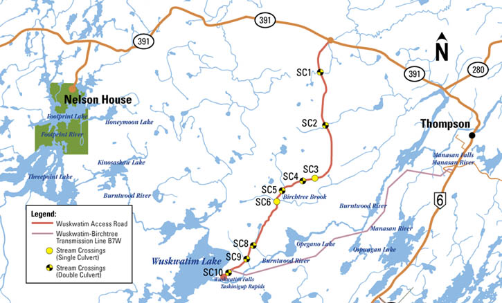
Site Overview
Shows the specific locations of the in-place station, camp area and work area at the Wuskwatim Generating Station site.
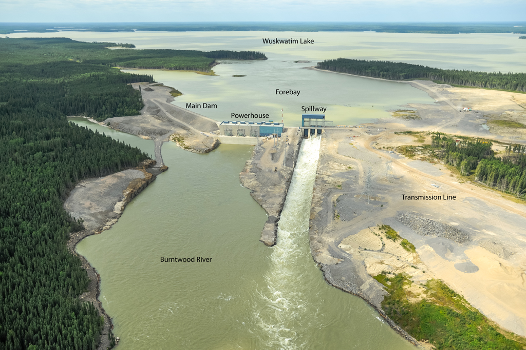
Wuskwatim Pre-construction Project Components (Aerial Photo)
Aerial photo close-up of Wuskwatim’s work area and proposed development.
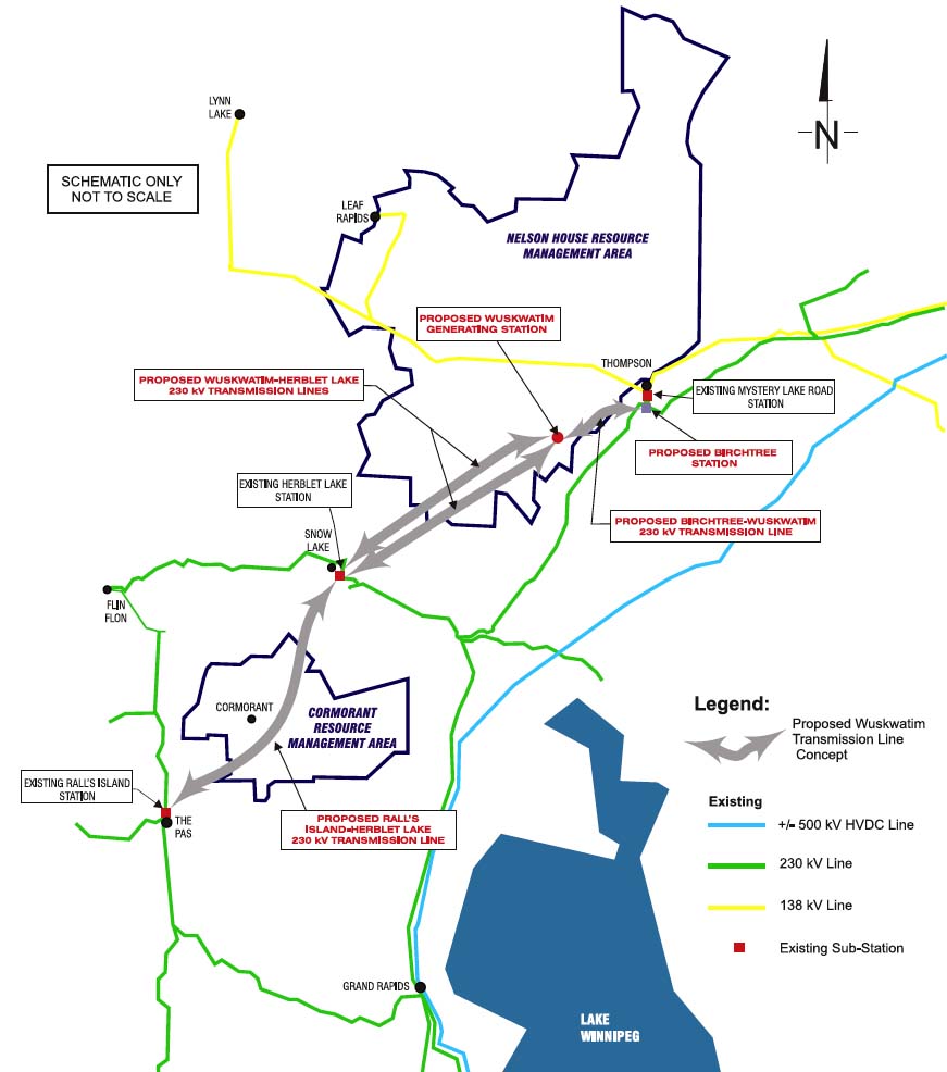
Wuskwatim Transmission Project
Shows the various components of the Wuskwatim Transmission Project, including the primary transmission line routes and station locations.
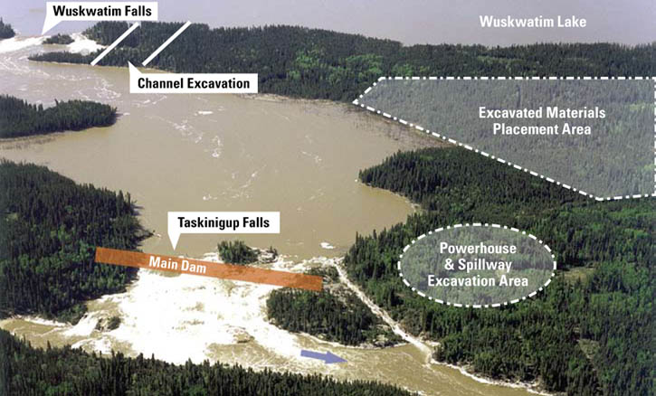
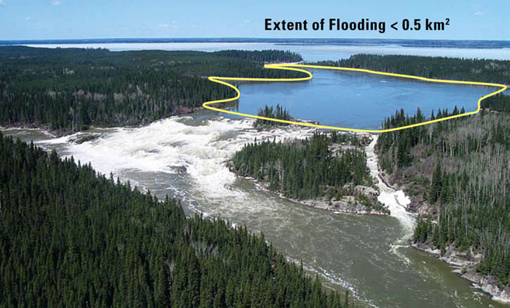
Extent of Flooding
Aerial photo indicating the extent of flooding to the shorelines.